Moturoa / Rabbit Island
As the name implies, Moturoa / Rabbit Island is the longest and largest of the islands in the Waimea Estuary. Its sandy beaches, bike tracks and scenic picnic spots make it a popular destination for locals and visitors. Aerial view of Rabbit Island, looking east.
As the name implies, Moturoa / Rabbit Island is the longest and largest of the islands in the Waimea Estuary. Its sandy beaches, bike tracks and scenic picnic spots make it a popular destination for locals and visitors.
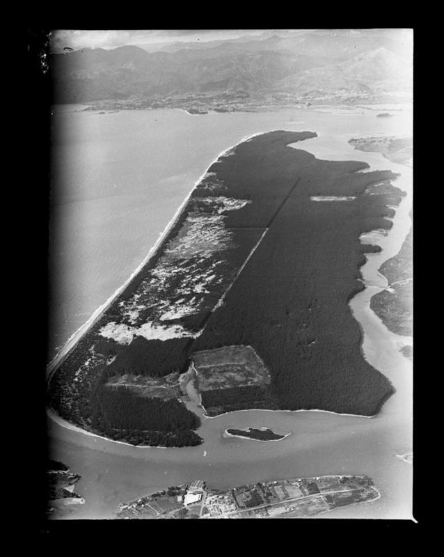
Aerial view of Rabbit Island, looking east. Baigent, Rabbit Island, Sept 1955. Nelson Provincial Museum, Kingsford Collection: 160072.
The natural environment
Today much of the inner part of the island is planted with commercial pine tree crops, but originally the low-lying flat land was covered in Harakeke (flax), low broadleaf forest, shrub, and dunes. Tasman Bay/Te Tai-o-Aorere is on one side of the island and the Waimea Estuary, shell banks, and the mouth of the Waimea River is on the other. This means there are several types of habitats, or homes, for plants, animals, and fish to live in. Some of the birds that make their home in the area are the banded rail, bar-tailed godwit (kakao), pied stilt (pōaka), and variable oystercatcher (tōrea pango).1
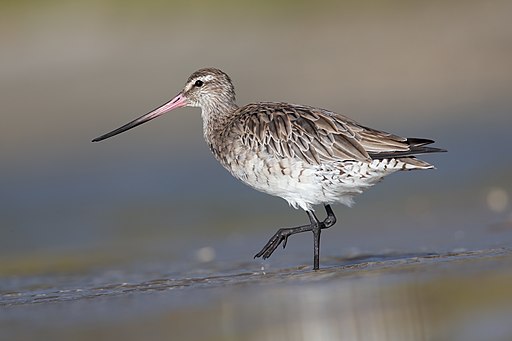
Bar-tailed Godwit (Limosa lapponica) JJ Harrison on Wikimedia Commons CC BY-SA 4.0
Māori history
Moturoa / Rabbit Island has been the site of Māori settlement since the 13th century. It is located along the traditional trading route between Whakatū (Nelson) and Te Tai Poutini (the West Coast). There was a fishing village nearby at Grossi Point in Māpua, and ancient gardens and pā across the estuary, near where Appleby School is today. The island was an important māhinga kai (place to gather food), camping, and waka landing site. There were also wāhi tapu (sacred places) across the island and rongoā (medicine) was harvested there. Iwi also cultivated a large mara harakeke (flax garden) on the island, with different varieties of flax grown for different purposes.2
European settlement
Europeans settling in the district in the early 1840s also saw the potential for farming on the island. John Wallis Barnicoat identified the island’s suitability for growing potatoes, and by October 1849 rabbits were being bred on or near the island. That month an agent for the New Zealand Company published a notice in the local newspaper warning ‘parties unlawfully trespassing upon the large island at the mouth of the Waimea River,’ and ‘destroying rabbits there in large quantities for sale’, that a game keeper had been appointed to the island and ‘no person whatever will be allowed to shoot, or otherwise kill or take away rabbits or other stock, or cut or remove any wood’, or they would be ‘proceeded against according to the law’.3,4
From the 1860s to 1890s game birds such as pheasants and California quail were taken by boat to the island, where they joined the growing rabbit population. By the mid-1880s, parts of the island had been leased to European settlers, including Henry Redwood, for grazing sheep.5 After the island was taken into Crown ownership it was set aside for other uses including as a quarantine ground for newly imported cattle, so they didn’t spread disease to cattle already in the area.6
Commercial forestry – land modification and development
Pine trees were first planted on the island in the 1880s, and in 1914, J.A. Hartley and sons planted Pinus radiata around the perimeter of the land they leased. However, it wasn't until 1921 that the first commercial pine plantations were established. That year the responsibility for running Moturoa / Rabbit Island and Rough Island was transferred from the Crown to Waimea County Council so they could develop the land. Unfortunately, the development of the island for forestry, removing native plants and bulldozing the land, caused the destruction of the harakeke swamps traditionally used by Māori, as well as the habitats of birds, plants, and animals.
During the economic depression in the 1930s, the island's pine forest was the site of a work relief camp for unemployed men. The men lived in the nearby stables formally used by Henry Redwood.7
Over the years development of the island has been proposed many times. Some of the schemes suggested for it include residential housing development, horticulture, aquatic centres, rowing venues and tourist resorts. Discovery of a three-metre ancient totara waka (canoe) on the island by caretaker Sol Whaanga in 1989, led to the proposal to build a multicultural education centre on site. The plan failed to get enough funding.
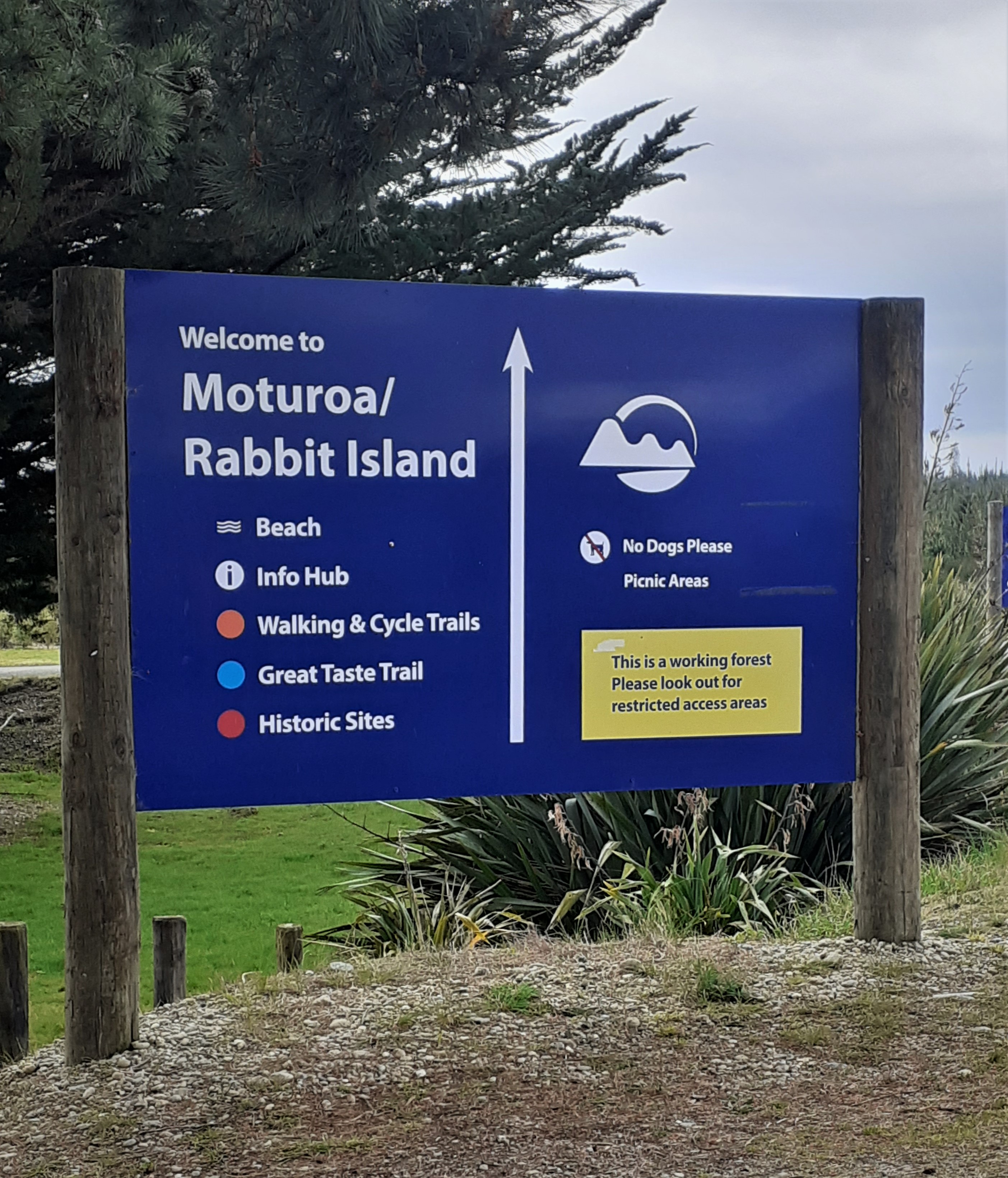
Signage at Moturoa / Rabbit Island. Tasman District Council.
Recreational uses
From 1851, the island was opened to the public as a recreation reserve, with sea-bathing and ‘cosy nooks for lunching’ popular. The sea-bathing was strictly segregated by gender, with men down one end of the beach, and ladies down the other. In the 1860s ‘pleasure excursions’, or day trips, to the island were a popular way to spend public holidays, with trips to the island from Nelson wharf on the paddle steamer Moutoa.8
In 1909/1910 the island was formally made a public recreation ground under the Public Reserves and Domains Act 1908 with the island managed by a locally elected Domain Board.
Open from dawn to dusk year-round, the main beach currently receives about 500 and 1000 visitors a day over the Christmas-January period. Sandcastle building, swimming, fishing, horse riding, boating, kite flying, and orienteering are some of the popular activities. In the last twenty years work has been done to improve the recreation areas, build walking and mountain bike tracks, and connect the island to Richmond along the Great Taste Trail cycle network.9
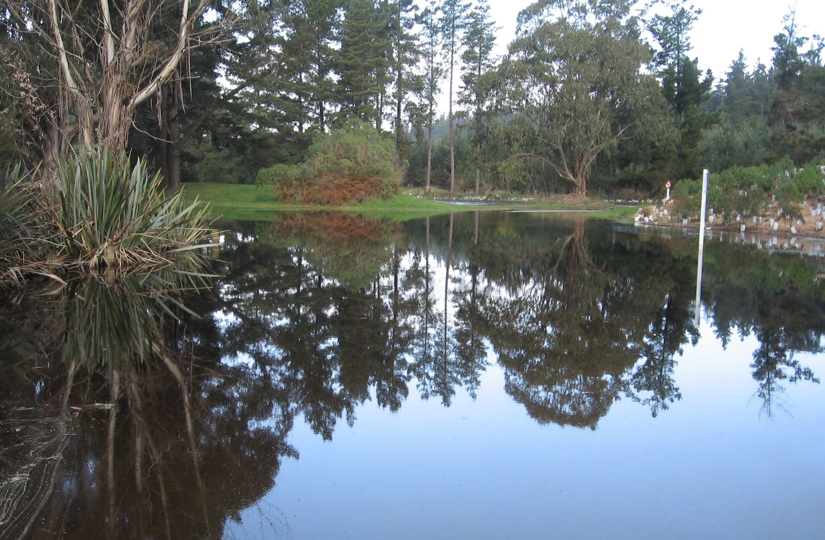
Flooding at Moturoa / Rabbit Island after the rain event in August 2022. Image from Tasman Heritage.
Threats – erosion and heavy rain
As low-lying coastal land, the island is vulnerable to erosion, damage from heavy rainfall events, and sea level rise. Erosion was identified as a problem as early as the 1930s after the mouth of the Waimea River shifted and sand from the eastern end of the island was swept away to Tāhunanui. In the 1980s the Waimea County Council placed rock and rubble along the beach front to try and protect the vertical bank.
More recently earthworks, native planting, trapping of pests (like rabbits), and other work has been done by iwi, Tasman District Council, the Department of Conservation, Waimea Inlet Forum, Waimea College and other groups, to protect and improve the ecological health of the island and the Waimea Inlet. This includes community planting, and beach clean-up days.10
Naming the land – Rabbit Island and Moturoa
There were several islands in Aotearoa New Zealand given the name Rabbit Island by European settlers. Rabbits were first brought to Aotearoa New Zealand by whalers and early European settlers for sport (hunting), meat, and skins. For a short time, they were also a good financial investment. Twelve silver-grey rabbits were introduced to Nelson in the 1850s by Captain Ruck Keene, but as mentioned in the section 'European settlement' above, it appears rabbits had arrived in the Waimea before that date.11 The name Rabbit Island, or 'The Rabbit island' became popular with European settlers sometime in the 1840s, probably due to the abundance of rabbits on the island. By about 1850 it was the name being used in government reports and survey maps of the island.
In the 1990s signposts on the island were changed to include the traditional name Moturoa, but it was not until August 2014 that the name of the island legally became ‘Moturoa / Rabbit Island’. The creation of the dual name, and official acknowledgement of the traditional name of the island, was part of the cultural redress during the Treaty of Waitangi Settlement with Ngāti Kuia. Ngāti Kōata, Te Ātiawa, Ngāti Tama and other Te Tau Ihu iwi also have a shared association with Moturoa or the “long island”.12,13
Many of the island's roads, pathways, and forestry blocks are named after former Waimea County Council chairpersons, or employees with forestry or caretaker responsibilities for the Island. This includes J.D. Beuke, George MacMahon, Philip Best and John Corder, who were all chairmen of the Waimea County Council in the early 1900s. Ken Beck managed the reserve as Waimea County engineer and developed the causeway (roadway) onto the island, Don Cooper, was the forestry manager, and Ira Heath was caretaker of the island in the 1960s.14
Other islands in the area
Bell Island, Best Island, Bird Island, Bullivant Island, Deadman’s Island, No-Man's Island, Pig Island, Oyster Island, Rough Island, Saxton’s Island.
2022
Story by: Tasman Libraries
Sources
- Department of Conservation. (December 2015). Waimea Inlet restoration Information for communities on best practice approaches. Motueka, N.Z: Department of Conservation.
https://www.doc.govt.nz/our-work/waimea-inlet-restoration-project/ - Young, A. (22 Feb 2021). Moturoa / Rabbit Island Biosolid Application Resource Consent Cultural Impact Assessment. Nelson, N.Z: Te Aranga Environmental Consultancy for Nelson Regional Business Unit.
https://www.tasman.govt.nz/ - Curran, C. (1988, November 26). Mixed reaction to recreational development of Rabbit Island. Weekender. Nelson Evening Mail. Page 7.
- Bell, F. D. (1849, October 27). Advertisements. Nelson Examiner and New Zealand Chronicle. Page 133.
https://paperspast.natlib.govt.nz/newspapers/nelson-examiner-and-new-zealand-chronicle/1849/10/27/1 - Sowman, W. C. R. (1993). Bernard Gapper: The Life & Times of an Early Settler. Journal of the Nelson and Marlborough Historical Societies, Volume 2, Issue 5. Pages 27-29.
https://nzetc.victoria.ac.nz/tm/scholarly/tei-NHSJ05_05-t1-body1-d5.html - Greenfield, A. (1854, November 1854). Government Notices. Nelson Examiner and New Zealand Chronicle. Page. 3.
https://paperspast.natlib.govt.nz/newspapers/NENZC18541111.2.12.1 - Gregory, K. (1976). Land of Streams. Life in the Waimea County Province of Nelson 1876-1976. Waimea: Waimea County Council. Page 52-53.
http://www.worldcat.org/oclc/3312229 - To the Editor. (1886, November 19). Nelson Evening Mail, Page 2.
https://paperspast.natlib.govt.nz/newspapers/NEM18861119.2.9.4 - Untitled. (1868, November 10). Nelson Evening Mail. Page 2.
https://paperspast.natlib.govt.nz/newspapers/NEM18681110.2.10 - Rogers, M. (1935, August 20). Rabbit Island Road. (Letter to the Editor). Nelson Evening Mail. Page 7.
https://paperspast.natlib.govt.nz/newspapers/NEM19350820.2.96 - Druett, J. (1983). Exotic Intruders. Auckland: Heinemann. Page 151.
https://nzetc.victoria.ac.nz/tm/scholarly/tei-DruExot-t1-body1-d9.html - New Zealand Gazetteer. Moturoa / Rabbit Island. New Zealand Geographic Board Ngā Pou Taunaha o Aotearoa.
https://gazetteer.linz.govt.nz/place/54604 - New Zealand Gazette. Notice of New and Altered Geographic Names, and Discontinued Crown Protected Area Names, for Ngati Apa ki te Ra To, Ngati Kuia, and Rangitane o Wairau Claims Treaty of Waitangi Settlement 2014, Ngati Koata, Ngati Rarua, Ngati Tama ki Te Tau Ihu, and Te Atiawa o Te Waka-a-Maui Claims Treaty of Waitangi Settlement 2014 and Ngati Toa Rangatira Treaty of Waitangi Settlement 2014. (4847). New Zealand Gazette.
https://gazette.govt.nz/notice/id/2014-ln4847 - Gregory, pages 53,113,133.
Further Sources
Books
- Best, H. (2006). Appleby. Wellington. N.Z: First Edition.
https://worldcat.org/en/title/156783533 - Esler, L. (2016). Rabbits & Possums in New Zealand. Invercargill. N.Z: Lloyd Esler.
https://worldcat.org/en/title/952455869 - Druett, J. (1983). Exotic Intruders. Auckland. N.Z: Heinemann.
https://nzetc.victoria.ac.nz/tm/scholarly/tei-DruExot-t1-body1-d9.html - Gregory, K. (1976). Land of Streams. Life in the Waimea County Province of Nelson 1876-1976. Waimea, N.Z: Waimea County Council.
http://www.worldcat.org/oclc/3312229 - Mitchell, H. & J. (2004). Te tau ihu o te waka: a history of Maori of Nelson and Marlborough. Volume 1 :te tangata me te whenua - the people and the land. Wellington, N.Z: Huia. Wellington, and Wakatu Incorporation.
http://www.worldcat.org/oclc/63170610 - Pestell, Jacqui and Appleby School. (2009). Lessons from the Past: Appleby School History 1859-2009. 1st ed. Nelson, N.Z: Appleby School.
https://worldcat.org/en/title/456697840
Newspapers
- Barnicoat, C. R. (1971, November). Waimea River Estuary. Nelson Historical Society Journal, Volume 2, Issue 5.pages 26-27.
https://nzetc.victoria.ac.nz/tm/scholarly/tei-NHSJ02_05-t1-body1-d7.html - Batchelor, B. (2008). Memories of Rabbit Island in My Early Years. Nelson Historical Society Journal, Volume 6, Issue 6. page 28- 29.
https://nzetc.victoria.ac.nz/tm/scholarly/tei-NHSJ06_06-t1-body1-d4.html - Dickinson, M. (1985, October) Nelson Racing in the Early Days. Journal of the Nelson and Marlborough Historical Societies, Volume 1, Issue 5. pages 19-21.
https://nzetc.victoria.ac.nz/tm/scholarly/tei-NHSJ04_05-t1-body1-d2.html - Sowman, W. C. R. (1993). Bernard Gapper: The Life & Times of an Early Settler. Journal of the Nelson and Marlborough Historical Societies, Volume 2, Issue 5. pages 27-29.
https://nzetc.victoria.ac.nz/tm/scholarly/tei-NHSJ05_05-t1-body1-d5.html
Maps
- Whaanga, Horopapara (Sol), (1990, January). Interview by unnamed woman [Tape recording]. Interview about Rabbit Island. Waimea County Council. Tasman District Library archives.
- NZ Heritage Maps Platform. Waimea. [1850? survey map of the Waimea River showing Moturoa/Rabbit Island as a quarantine reserve]. Accessed 10 Jan 2023.
https://maps.recollect.co.nz/nodes/view/504